Kuakata


Destination Bangladesh :: Kuakata
Kuakata : Kuakata, locally known as Sagar Kannya (Daughter of the Sea) is a rare scenic beauty spot on the southernmost tip of Bangladesh. Kuakata in Latachapli union under Kalapara Police Station of Patuakhali district is about 30 km in length and 6 km in breadth. It is 70 km from Patuakhali district headquarters and 320 km from Dhaka. At Kuakata excellent combination of the picturesque natural beauty, sandy beach, blue sky, huge expanse of water of the Bay and evergreen forest in really eye-catching.

The name Kuakata have originated from Kua-Well dug on the sea shore by the early Rakhine settlers in quest of collecting drinking water, who landed on Kuakata coast after explled from Arakan by Moughals. Afterwards, it has become a tradition of digging Kua-Well in the neighbourhood of Rakhaine homestead for collection water for drinking purpose and general use.

Tourist Attractions : Kuakata is one of the rarest places which has the unique beauty of offering the full view of the rising and setting of crimson sun in the water of the Bay of Bengal in a calm environment. That perhaps makes Kuakata one of the world's unique beaches. The long and wide beach at Kuakata has a typical natural setting. This sandy beach has gentle slopes into the Bay of Bengal and bathing there is as pleasant as is walking or diving.

Kuakata is truly a virgin beach-a sanctuary for migratory winter birds, a series of coconut trees, sandy beach of blue Bay, a feast for the eye. Forest, boats plying in the Bay of Bengal with colourful sails, fishing, towering cliffs, surfing waves everything here touches every visitor's heart. The unique customs and costumes of the 'Rakhyne' tribal families and Buddhist Temple of about hundred years old indicate the ancient tradition and cultural heritage, which are objects of great pleasure Kuakata is the place of pilgrimage of the Hindus and Buddhist communities.

Innumerable devotees arrive here at the festival of 'Rush Purnima' and 'Maghi Purnima'. On these two days they take holy bath and traditional fairs are held here. All these additional offers to panoramic beauty make the beach more attractive to the visitors. One should visit Kuakata and discover the lovely grace of Bangladesh.
Means of Communication : There exists road commiunication between
Dhaka and Patuakhali district headquaters. Accessible by road, water or air transport up to Barisal. Then one may travel by road or water to Kuakata or Patuakhali.

BRTC has introduced direct bus service from Dhaka to Kuakata via Barisal. Besides that, Bangladesh Parjatan Corporation, National Tourism Organization may organize guided package tours from.

Parjatan Facilities : Parjatan Holiday Homes at Kuakata is an ideal tourist resort having a number of facilities for the tourists.

1.Deluxe Motel 10 twin rooms


2.Dormitory 30 beds

3.Resturant 50 seating

Other facilities : A pond of crystal clean sweet water beside the motel attract the tourists.
For advance reservation and further details one may contact :

Central Reservation, Bangladesh Parjatan Corporation.
Head Office, 233,
Airport Road, Tejgaon, Dhaka

Kuakata, Bangladesh

Kuakata is one of the rarest places which has the unique beauty of offering the full view of the rising and setting of crimson sun in the water of the Bay of Bengal in a calm environment. That perhaps makes kuakata one of the world's unique beaches. The long and wide beach at Kuakata has a typical natural setting. This sandy beach has gentle slopes into the Bay of Bengal and bathing there is as pleasant as is walking or diving. Kuakata is truly a virgin beach-a sanctuary for migratory winter birds, a series of coconut trees, sandy beach of blue Bay, a feast for the eye. Forest, boats plying in the Bay of Bengal with colourful sails, fishing, towering cliffs, surfing waves everything here touches every visitor's heart. The unique customs and costumes of the 'Rakhyne' tribal families and Buddhist Temple of about hundred years old indicate the ancient tradition and cultural heritage, which are objects of great pleasure Kuakata is the place of pilgrimage of the Hindus and Buddhist communities. Innumerable devotees arrive here at the festival of 'Rush Purnima' and 'Maghi Purnima'. On these two days they take holy bath and traditional fairs are held here. All

these additional offers to panoramic beauty make the beach more attractive to the visitors. One should visit Kuakata and discover the lovely grace of Bangladesh.


Kuakata Sea Beach, Bangladesh

Kuakata is a scenic sea beach in south-western Bangladesh. It is about 320 Kilometres south of Dhaka, the capital, and about 70 Kilometres from the Patuakhali District headquarters. The kuakata beach is 30 km long and 6 km wide.

It is a famous destination for people around Bangladesh and from overseas. The most important attraction of the beach is that one can see both sunrise and sunset from some of its locations.

© All rights reserved do not use the photo without permission.


Kuakata: to enjoy the beautiful sea beach, both sunrise and sunset

Bangladesh got the special blessings of nature. Many very beautiful places surround it. Kuakata is one of them. It is a wide sandy beach with a mind blowing scenic beauties. Travelers of diverse places come here to enjoy this unique beauties. Kuakata is located on the south western part of Bangladesh. It is in Potuakhali district and about 70 kilometers .
north of the town. It is the beach where you can enjoy the amazing scene of both sunrise and sunset. These features attract a lot of tourists from both home and abroad to travel kuakata. Previously tourists did not feel comfort there due to poor transport and poor housing places. But recent times a lot of development done by the government and local business owners. After sunset you can go to the Rakhaine market where you can find several goods made by tribal Rakhaine peoples and also observe their lifestyle. If you are lucky you may enjoy cultural shows presented by this Rakhaine people. You can see the highest budhdha incarnation of Bangladesh at misripara, which is 12 kilometers away from kuakata beach. There are also some places where you may like to visit. You can see Gangamati which is a forest reserve and Fatrar chor which is a mangrove forest and part of world famous Sundarban. During Maghi purnima and rush purnima a lot of people arrive here to have holy bath. Traditional fairs are also arranged. Kuakata is a virgin place of migratory winter birds. A lot of birds come here during winter. Coconut forest and the waves of the bay of Bengal will touch your heart.

THE HISTORY OF KUAKATA

If we try to find out the history of kuakata we will find that, a long time ago (around 1784) Barmiest King "Bodofoa" illegally took position at "Arakan", on the home land of Rakhains and started to kill them. So many of them started to leave their homeland to save their lives. A part of them came in "Rangabali" Ireland in Galachipa by boat. A big part of them started to live in Kuakata and Kolapara. They started to live beside sea and felt shortage of drinking water. So dug two "Kuas" in of getting fresh drinking water. From this digging of "Kua" the name of the place became "Kuakata


Chandpur


Chandpur District Information
Area : 1704.06 square kilometers.

Bounded by:
Munshiganj and Comilla districts on the north, Noakhali, Lakshmipur and Barisal districts on the south, Comilla district on the east, meghna river, Shariatpur and Munshiganj districts on the west.

Profile:
Chandpur sub-division was established in 1878 and was included in Tripura district. It was turned into a district in 1984. The district consists of 6 municipalities, 60 wards, 195 mahallas, 7 upazilas, 1 thana, 87 union parishads and 1226 villages. The municipalities are Chandpur Sadar, Shahrasti, Matlab, Chengerchar, Hajiganj and Kachua and the upazilas are chandpur sadar, hajiganj, kachua, faridganj, matlab, haimchar and shahrasti.

Chandpur District is located in Chittagong Division. Districts in Chittagong Division are Bandarban, Brahmanbaria, Chandpur, Chittagong, Comilla, Cox's Bazar, Feni, Khagrachhari, Lakshmipur, Noakhali, and Rangamati.

Upazilla/ Thana:
Chandpur Sadar Upazila, Faridganj Upazila, Haimchar Upazila, Hajiganj Upazila, Kachua Upazila, Matlab Upazila, Shahrasti Upazila

Places to see:
Rasti Shah Dargah, Begum Mosque, Hajiganj Bara Mosque, Suja Mosque, Alamgiri Mosque, Mada Khan Mosque, Kalimandir at Matlab, Math at Lohagara, Math at Naorai, Math at Tultuli (Kachua), Raths at Sachar and Matlab, Pata of Behula at Ujani, ramnants of the fort at Nasir Court, Kali Bari at Meher, Neelkuthi at Shahebganj, Baraduara at Kasimbazar, Kalibari Mandir (1878) at Chandpur Sadar.

Chandpur, Bangladesh:

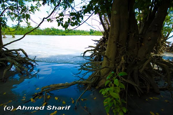
Chandpur District (chittagong division) with an area of 1704.06 sq km, is bounded by munshiganj and comilla districts on the north, noakhali, lakshmipur and barisal districts on the south, Comilla district on the east, meghna river, shariatpur and Munshiganj districts on the west. River erosion is a common feature in this district. The Padma and the Meghna meet near Chandpur Town and take a vast expanse. Main tributaries of the Meghna are Dakatia, Dhanagada, Matlab and Udhamdi. Ghorgaon Jala is a beel. Annual average temperature-maximum 34.3°C, minimum 12.7°C; annual average rainfall 2551 mm.
Chandpur (Town) a municipal town, stands on the bank of the Meghna. Its area is 7.77 sq km. It consists of 15 wards and 75 mahallas. The town has a population of 94821; male 50.77%, female 49.23%. Literacy rate among the town people is 56.4%. Chandpur Municipality was established in 1897. In the map of Greater Bengal by James Renel Chandpur has been exactly indicated along with Tripura. JN Sengupta thinks that Chandpur was named after zamindar Chand Ray of Bikrampur. Some people think that it was named after darvish Chand Fakir of village Koralia adjacent to the town. Again, some people think that it was named after Chand Sawdagar of the maimansingha gitika who used to come to this port for trade with his Swapta Dinga "Madhukar". During the first part of the twentieth century some European and Indian business firms

established several jute mills here. But with the partition of Indian sub continent in 1947 most of these business establishments were closed down. This port was an important centre for jute and grain trades. Besides, many other trades on ship building, salt refinery, fishing net making and oil production are present in this port. However, some parts of the town have submerged into riverbed due to erosion and the Puran (old) Bazar is now under threat of river erosion. Since 1973 Tk 35 crores have been spent to build town protection dam with blocks.
Administration Chandpur sub-division was established in 1878 and was included in Tripura district. It was turned into a district in 1984. The district consists of 6 municipalities, 60 wards, 195 mahallas, 7 upazilas, 1 thana, 87 union parishads and 1226 villages. The municipalities are Chandpur Sadar, Shahrasti, Matlab, Changer Char and Hajiganj and the upazilas are chandpur sadar, hajiganj, kachua, faridganj, matlab, haimchar and shahrasti.
Archaeological heritage and relics Rasti Shah Dargah, Begum Mosque, Hajiganj Bara Mosque, Suja Mosque, Alamgiri Mosque, Mada Khan Mosque, Kalimandir at Matlab, Math at Lohagara, Math at Naorai, Math at Tultuli (Kachua), Raths at Sachar and Matlab, Pata of Behula at Ujani, ramnants of the fort at Nasir Court, Kali Bari at Meher, Neelkuthi at Shahebganj, Baraduara at Kasimbazar, Kalibari Mandir (1878) at Chandpur Sadar.
Marks of War of Liberation Memorial monument "Aungikar", Amra tomader bhulbana (we shall never forget you) at Faridganj, "Dipta Bangladesh" at Matlab and Chandrakandi memorial monument (Sadullahpur, Matlab); mass killing site: Raghunathpur Bazar (Hajiganj), Hamidia Jute Mils Compound, North and south Ray Sree; mass grave: Nasircourt (Hajiganj).
Population 2210162; male 48.67%, female 51.33%; Muslim 92.55%, Hindu 7.18%, Buddhist 0.06%, Christian 0.07% and others 0.14%.
Religious institutions Mosque 2852, temple 286, Church 2, most noted religious institutions are Begum Mosque, Puran Bazar Mosque, Shah Suja Mosque, Firoz Khan Mosque, Pasha Ghazi Mosque, Palgiri Mosque, Madakhan Mosque, Rasti Shah Dargah, Akra of Lakhinarayan Jeor, Chandpur Kalibari, Ajachak Asram, Kundubari Durga Mandir, Ramkrishna Mission, Harisava, New Zealand Baptist Missionaries, Meher Kali Bari.
Literacy and educational institutions Average literacy 37.8%; male 42.7%, female 33%. Educational institutions: university college 1, government college 2, non-government college 36, primary teacher's training institute 1, government high school 6, non-government high school 224, madrasa 1157, government primary school 786, non-government primary school 684, mass education school 76, BRAC school 28, community school 61, satellite school 37, kindergarten school 11, government deaf and dump school 1.
Locally published newspapers and periodicals Dainik Chandpur Kantha, Chandpur Darpan; Weekly Chandpur Sangbad, Weekly Chandpur Sangbad, Weekly Rupasi, Weekly Dibachitra, Weekly Hajiganj; extinct- Nababanga (1947), Alo (1947), Weekly Annagram (1960), Bharat Hitashi, Rakta Palash, Raktim Surya and Mohana.
Cultural organisations Club 460, public library 9, cinema hall 12, theatre group 14, literary society 5, park 2, youth organisation 45, cooperative society 3129, voluntary organisation 451 and women's organisation 15.
Main occupations Agriculture 35.13%, fishing 3.03%, agricultural labour 20.04%, wage labourer 3.15%, commerce 12%, transport 2.24%, construction 1.64%, service 11.68%, others 11.09%.
Land use Total land 167009 hectares, cultivable land 112210 hectares; fallow land 48311 hectares; single crop 15.03%, double crop 59.93% and treble crop 25.04%; land under irrigation 60921 hectares.
Land control Among the peasants 22% are landless, 27% marginal, 39% small, 10% intermediate and 2% rich; cultivable land per head 0.08 hectare.
Value of land The market value of the land of the first grade is Tk 10000 per 0.01 hectare.
Main crops Paddy, jute, mustard seed, supari (nut), wheat, potato and sugarcane.
Extinct or nearly extinct crops Linseed, sesame, kaun and china, local variety of rice, varieties of dal (pulse).

Main fruits Mango, jackfruit, papaya, banana, papaya, coconut, palm and guava.
Fisheries, dairies, and poultry's Poultry 331, dairy 92, fishery 4076 and hatchery 113.
Communication facilities Roads: pucca 215 km, semi pucca 91 km and mud road 1407 km; railways: 50 km; waterways: 190 nautical mile.
Traditional transport Palanquin, bullock cart and horse carriage. These means of transport are either extinct or nearly extinct.
Manufactories Jute mills 11, rice and flour mill 185, ice factory 14, cold storage 4, chemical industries 1, iron work 3, aluminum product 1, match factory 2.
Cottage industries Cottage industries include weaving, shital pati, potteries, bamboo and cane work, fishing net making, blacksmith, tailoring, goldsmith.
Hats, bazars and fairs Total number of hats and bazars are 213, most noted of which are Puran Bazar, Natun Bazar, Baburhat, Kachua, Faridganj, Fatehpur, Suchipara, Begum Bazar, Hajiganj, Warukh, Matlab, Shahtali, Satnal; noted fairs are Austami Snan Mela (Chandpur), Meher Kali Mela (Shahrasti), Paush Samkranti Mela, Bijoy Mela, Asutami Mela (Aliganj, Hajiganj), Beltali Mela (Matlab) and Boi (book) Mela.
Main exports Hilsa fish, shrimp, betel nut and potato.
NGO activities Operationally important NGOs are brac, asa, CARE, grameen bank, Autta Nibedita, Aman, DPHE, BAVS, VOSD, Save Our Life.
Health centres Zila sadar hospital 1, charitable dispensary 1, upazila health complex 7, satellite clinic 20, health and family welfare centre 76, maternity centre 3, eye hospital 1, diabetic hospital 1, red crescent hospital 1, tuberculosis hospital 1, private clinic 6, railway hospital

Commilla


Comilla District Infrmation

Area: 3085.17 square kilometers.

Bounded by: Brahmanbaria and Narayanganj districts on the north, Noakhali and Feni districts on the south, Tripura (state of Isndia) on the east, Munshiganj and Chandpur districts on the west.

Profile: The Comilla region was once under ancient Samatat and was joined with Tripura State. This district came under the reign of the kings of the Harikela in the ninth century AD. Lalmai Mainamati was ruled by Deva dynasty (eighth century AD), and Chandra dynasty (during tenth and mid eleventh century AD). It came under the rule of East India Company in 1765. This district was established as Tripura district in 1790. It was renamed Comilla in 1960. Chandpur and Brahmanbaria subdivisions of this district were transformed into districts in 1984. Comilla district has 5 municipalities, 54 wards, 148 mahallas, 12 upazilas, 1 thana, 180 union parishads, 2704 mouzas and 3624 villages.

Comilla District is located in Chittagong Division. Districts in Chittagong Division are Bandarban, Brahmanbaria, Chandpur, Chittagong, Comilla, Cox's Bazar, Feni, Khagrachhari, Lakshmipur, Noakhali, and Rangamati.


Upazilla/ Thana: Barura Upazila, Brahmanpara Upazila, Burichang Upazila, Chandina Upazila, Chauddagram Upazila, Comilla Sadar Upazila, Daudkandi Upazila, Debidwar Upazila, Homna Upazila, Laksham Upazila, Muradnagar Upazila, Nangalko Upazila


History: Peasants Movement against the king of Tripura in 1764 under the leadership of Samsher Gazi is a notable historical event. Communal tension spread over Comilla when a Muslim was shot at Comilla town during the partiition of bengal in 1905. During the preparation of a countrywide hartal on 21 November 1921, protesting the visit of India by Prince of Wales, Kazi Nazrul Islam composed patriotic songs and tried to awaken the town people. During this time Avay Ashram, as a revolutionary institution, played significant role. Poet Rabindranath Tagore and Mahatma Gandhi visited Comilla at that time. In 1931, the British Gurkha soldiers fired indiscriminately and killed four persons of village Mohini of Chauddagram upazila when about four thousand peasants of this village revolted against paying land revenue. In a huge peasant gathering the police fired at Hasnabad of Laksham Upazila in 1932. Two persons were killed and many wounded in this firing.

Places to see: Marks of rich ancient civilization have been found in Lalmai Mainamati hills. In these hills there are plenty of archaeological sites including Shalvan Vihara, Kutila Mura, Charandra Mura, Rupban Mura, Itakhola Mura, Satera Ratna Mura, Ranir Banglar Pahar, Ananda Bazar Palaces, palaces of Bhoj King, Chandi Mura, etc. Various archaeological relics including images and metalled utensils discovered from these viharas, muras and palaces are now preserved in the Mainamati Museum. Other archaeological heritage and relics include Saptaratna Mandir (Jagannath Mandir), Shah Suja Mosque, Dharmasagar, Chandimata Mandir (on the top of Lalmai Hill of Barura), Chandala Shiva Mandir (Brahmanpara, eighteenth century), Saitshala Jami Mosque (Brahmanpara, 1719), Mazars of Panch Pir (five saints) at Shashidal (Brahmanpara, 1815), Harimangal Math (Brahmanpara, 1822), Ramnagar elongated Math (Brahmanpara, 1705), Saitshala Rammahan Mandir (Brahmanpara, 1805), Hasnabad Math and Hatiabhanga Fort (Daudkandi).

Rivers: meghna, gumti and dakatia.


Comilla District

Comilla District is a district of Bangladesh located about 100 kilometers south east of Dhaka. Established as a district of Bengal by the British in 1790, it included the Sub-divisions of Brahmanbaria and Chandpur which eventually became separate districts in 1984.

Comilla is bordered by Brahmanbaria and Narayanganj districts to the north, Noakhali and Feni districts to the south, Tripura of India to the east, and Munshiganj and Chandpur districts to the west.

Geography and climate

Comilla has a total area of 3085.17 square kilometers. It is bounded by Burchiganj and Tripura on the north, Laksham and Chauddagram on the south, and Barura on the west. Major rivers passing through Comilla include Gumti and Little Feni.

Administration

The headquarters of Comilla are located in the city of Comilla which has a total area of 11.47 square kilometers. It consists of 18 mouzas and 3 wards. Comilla thana was officially converted into an upazilla in 1983 which contains one municipality 18 wards, 19 union parishads, 452 mouzas and 458 villages.


Economy

Mainly based on agriculture, the economy of Comilla has been flourished through trade and cottage industries, especially the 'Khadi' textile. For the economic development of the region the "Bangladesh Export Promotion Zone Authority" has established the "Comilla Export Processing Zone" spread over an area of 104.44 hectares (258 Acres) in the Comilla old Airport Area.

Places of Interest

Important landmarks include Kotbari, a cantonment, or military installation and Kandirpar, considered the heart of the Comilla district. Ancient Buddhist Monastery ruins are the major attraction of Mainamati, near Kotbari. There is also a Second World War cemetery located about 3.1 km away from Comilla Cantonment, which was a frontier military base in the fight against the Japanese who had occupied Burma. British Army soldiers killed during the fight with the Japanese Army at the Burma (Myanmar) frontier were buried here. Pashchimgaon Nawab Bari, the place of only lady Jaminder Faizunnesa, a poet, educationist and a great donor.

Kazi Nazrul Islam, the national poet of Bangladesh, passed significant time of his life in this town. Both his wives, Promila Devi and Nargis, hailed from this district.

Comilla Victoria College and Comilla Zilla School are two ancient and famous college and school in the country. Comilla Zilla School was established in the year of 1837. Bangladesh Academy for Rural Development (BARD) is situated in Kotbari.

Situated by the bank of the river Ghumti, Comilla is also famous for some tanks such as 'Dhormo Sagor', 'Ranir Dighi', 'Nanuar Dighi', 'Ujir Dighi' etc.

Mainamati

About eight km. to the west of Comilla town and 114 km. south-east of Dhaka lie the low hills of Mainamati-Lalmai ridge - an old centre of Buddhist culture. On the slopes of these hills lie scattered runis that testity to as a early Buddhist civilization (8th to 12th century). At Salban in the middle of the ridge, excavations have laid bare a large Buddhist Vihara (monastery) and an imposing central shrine. Further explorations have revealed valuable information on the rule of the Chandra and Deva dynasties which flourished here from the 8th to 12th century A.D. The whole range of hillocks run for about 18 km and is studded with more than 50 such sites. A site museum houses the archaeological finds that include terracotta plaques, bronze statues and caskets, coins, jewellery, utensils, pottery and votive stupas embossed with Buddhist inscriptions.

Lalmai Moinamoti and Shalbon Bihar

They are famous historical and archeological places around Comilla. These are a series of hillocks, where the Northern part is called Moinamoti and the Southern part is called Lalmai; and Shalbon Bihar is in the Middle of Lalmai and Moinamoti, which the was established in 8th century by King Buddadev. Salban Vihara, almost in the middle of the Mainarnati-Lalmai hill range consists of 115 cells, built around a spacious

courtyard with cruciform temple in the centre facing its only gateway complex to the north resembling that of the Paharpur Monastery. Kotila Mura situated on a flattened hillock, about 5 km north of Salban Vihara inside the Comilla Cantonment is a picturesque Buddhist establishment. Here three stupas are found side by side representing the Buddhist "Trinity" or three jewels i.e. the Buddha, Dharma and Sangha. Charpatra Mura is an isolated small oblong shrine situated about 2.5 km. north-west of kotila Mura stupas. The only approach to the shrine is from the East through a gateway, which leads to a spacious hall. If you are in Comilla and already visited Lalmai, Moinamoti then dont miss to go Moinamoti museum where you will find the historical things found in Lalmai & Moinamoti of 7th & 8th centuries. The Mainamati site Museum has a rich and varied collection of copper plates, gold and silver coins and 86 bronze objects. Over 150 bronze statues have been recovered mostly from the monastic cells, bronze stupas, stone sculptures and hundreds of terracotta plaques each measuring on an average of 9" high and 8" to 12" wide. Mainamati is only 114 km. from Dhaka City and is just a day's trip by road on way to Chittagong.


Rangamati


Rangamati District Information
Area: 6116.13 square kilometers.
Bounded by:
the Tripura State of India on the north, Bandarban district on the south, Mizoram State of India and Chin State of Myanmar on the east, Khagrachhari and Chittagong districts on the west.

Profile:
Rangamati subdivision was turned into a district in 1983. It consists of 10 upazilas, 1 municipality, 9 wards, 35 mahallas, 50 union parishads, 162 mouzas and 1347 villages.

Rangamati District is located in Chittagong Division. Districts in Chittagong Division are Bandarban, Brahmanbaria, Chandpur, Chittagong, Comilla, Cox's Bazar, Feni, Khagrachhari, Lakshmipur, Noakhali, and Rangamati.

Upazilla/ Thana:
Baghaichhari Upazila, Barkal Upazila, Belaichhari Upazila, Juraichhari Upazila, Kaptai Upazila, Kawkhali Upazila, Langadu Upazila, Nannerchar Upazila, Rajasthali Upazila, Rangamati Sadar Upazila

History:
Before the Muslim conquest Rangamati region was a contesting ground between the kings of the Tripura and the Arakan. In 1966 this region came under the Mughals. It was leased to the English East India Company in 1760-61. In 1737 one tribal leader Sher Mosta Khan took refuge with the Mughals. From this time onward the Chakmas settled in this region who were followed by other ethnic nationals.

Rangamati District:
(CHITTAGONG division) with an area of 6116.13 sq km, is bounded by the Tripura State of India on the north, BANDARBAN district on the south, Mizoram State of India and Chin State of Myanmar on the east, KHAGRACHHARI and CHITTAGONG districts on the west. Annual average temperature: maximum 34.6°C, minimum 13.4°C; annual rainfall 3031 mm. Rivers are KARNAFULI, Thega, Horina, Kassalong, Shublang, Chingri, Rainkhiang and Kaptai.
Rangamati (Town) a municipal town, consists of 9 wards and 35 mahallas. The area of the town is 64.75 sq km. The town has a population of 65294; male 57.68%, female 42.32%. Density of population is 1008 per sq km. Literacy rate among the town people is 60.8%. The town has one dakbungalow.
Administration Rangamati subdivision was turned into a district in 1983. It consists of 10 upazilas, 1 municipality, 9 wards, 35 mahallas, 50 union parishads, 162 mouzas and 1347 villages. The upazilas are BAGHAICHHARI, BARKAL, KAWKHALI, BELAICHHARI, KAPTAI, JURAICHHARI, LANGADU, NANNERCHAR, RAJASTHALI and RANGAMATI SADAR.
Archaeological heritage and relics Palace, dighi and mosque of Raja Jan Bashk Khan, remnants of the residence of Raja Harish Chandra Roy and the hanging bridge.
Historical event Before the Muslim conquest Rangamati region was a contesting ground between the kings of the Tripura and the Arakan. In 1966 this region came under the Mughals. It was leased to the English East India Company in 1760-61. In 1737 one tribal leader Sher Mosta Khan took refuge with the Mughals. From this time onward the Chakmas settled in this region who were followed by other ethnic nationals.
Population 507180; male 53.59%, female 46.41%; Muslim 39.28%, Hindu 5.62%, Christian 1.12%, Buddhist 53.83%, and others 0.15%; ethnic nationals: Chakma, Bome, Chak, Khumi, Kheyang, Lusai, Mo, Murang, Panku, Santal, Manipuri.
Literacy and educational institutions Average literacy 36.5%; male 45.8% and female 24.7%. Educational institutions: government college 2, non-government college 13, government high school 6, non-government high school 45, junior school 22, government primary school 291, non-government primary school 120, madrasa 61, technical school 7.
Cultural organisations Club 155, public library 3, cinema hall 5, officers club 2, shilpakala academy 2.
Main occupations Agriculture 41.94%, agricultural labourer 12.06%, wage labourer 4.95%, commerce 8.22%, service 13.04%, fishing 2.02%, industry 4.57%, forestry 3.2% and others 10%.
Land use Cultivable land 12275 hectares.
Value of land Market price of cultivable land is approximately Tk. 10000 per 0.01 hectare.
Main crops Paddy, jute, potato, cotton, corn, mustard seed.
Main fruits Mango, jackfruit, banana, pineapple, litchi, black berry.
Manufactories Major manufactories include Chandraghona Paper and Rayon Mill, Plywood Factory, Hydro-electric Project, Satellite Station at Betbunia, Ghagra Textile Mills, etc.
Cottage industries Weaving, goldsmith, blacksmith, wood work, welding, etc.
Main hats and bazars Major hats and bazars include Marisha, Dudchhari, Maini, Sublang, Rangamati, Kaptai, Bangalhalia, Roykhali, Baraichhari, Ghagda, Kawkhali, Kutubchhari, Naniarchhar, Barkal, Baghaichhari, Belaichhari, Juraichhari, Langadu, Rajasthali.
Main exports Timber, jackfruit, pineapple, forest goods.
Health centres Upazila health complex 10, union health centre 28, family planning centre 48

Rangamati-It is an excellent scenic beauty and lakeside location North Eastern part of Bangladesh.
Rangamati is 77 km away from Chittagong.It is a district headquarters of Rangamati district of Chittagong Hill Tracts of North Eastern part of Bangladesh.Rangamati is surrounded by lake which is excellent location that attracts the tourist or visitors anywhere in the World. From Chittagong,on way to Rangamati you can find beautiful road, lush green fields, and sometimes beautiful forest hills.The Rangamati town is located is on the western bank of Kaptai Lake. The town is free from pollution and is not busy traffic at all.
Rangamati is a favourites holyday resort of it is scenic beauty and its lakeside location, its
colourful tribe, homespun textile product, ivory and jewellery and traditional handicrafts. The main inhabitant of Rangamati is Chakmas,Dewan and Talukdar and Moghs,besides,there is non-tribal communities are also staying in the Rangamati town. The Chakmas tribe are Buddhist by religion, they are simple and hospitable people and also well educated in compare to other cast, the Chakmas colourful and traditional dress are quite excellent.
It is here to be mentioned that, one religious tourist place in Rangamati which is called“BanaVihara’means Buddhist Temples. Which is beautiful architectural design. It is sacred place of Rangamati.The temple is surrounded by lake, it is not fulfill for the visiting tourists if he or she does not visit the temples inside.

For the tourist attraction of Rangamati are numerous, speedboat cruising, water sking,bathing or merely enjoying the nature as it is. It is rare tourists spot of eco-tourism, rural tourism and adventure tourism. Visitors are fascinated by the rich culture of its tribal people, a visit of tribal museum and the hanging bridge on the lake is must. In Rangamati Town, there is traditional local shop, especially handicraft and textiles like,BenTextiles,Banani Textile etc which is fascinated by the tourists.
It may here to be mentioned that,Khattolly Bil and Jhoghora Bil[Biggest Lakes] are wonderful scenic beauty in Rangamati district.
Bangladesh Parjatan Corporation provides good hotels and cottage accommodation,auditorium,catering and other facilities at Rangamati.Besides that, many budget private hotels are available in Rangamati.Traditional hotels like,Sabarang and Peda Ting Ting are available in Rangamati.
Parjatan Motel,Rangamati,
Phno-0088-035163126,61046.

Rangamati - the lake district

From Chittagong, a 77 km. winding road that passes through lush green fields and forested hills take you to Rangamati at the heart of the lake district. The township is located on the western bank of Kaptai Lake. Rangamati is a favourite holiday resort because of its scenic beauty and its lakeside location, its colourful tribes, homespun textile products, ivory and jewellery

For tourists the attractions of Rangamati are numerous, speedboat cruising, water skiing, bathing or merely enjoying nature as it is. It is a rare spot for eco-tourism. Visitors are fascinated by the rich culture of its ethnic people. A visit to the tribal museum and the hanging bridge on the lake a must.

Bangladesh Parjatan Corporation provides good hotel and cottage accommodation, auditorium, catering, speedboat and other facilities at Rangamati.

Guid line : You can go by bus or air bus from Dhaka of Bangladesh. Some Hotele

1. Hotel Green castle
Addess:1 Pathar Ghata, Rangamati phone:0351-63282

2. Hotel Lake View
Addess:Resurv Bazar, Rangamati phone:0351-3373

3.Hotel Shapla
Addess:New Court Building Banarupa, Rangamati phone:0351-3396

4.Hotel Sufia
Addess:Kathalthati, Rangamati phone:0351-2145,0351-2314